Description: JPEG image
|
| From: | Kadir ÇİMENCİ |
| Subject: | Re: [Paparazzi-devel] AGL or MSL in flight plan |
| Date: | Sat, 22 Mar 2014 18:58:56 +0200 |
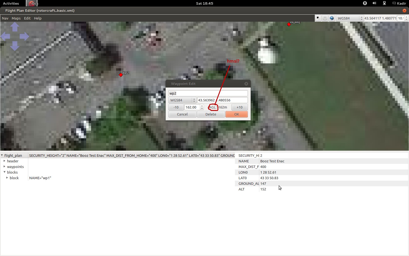
Hi Kadir,as described on https://wiki.paparazziuav.org/wiki/Flight_Plans#Waypoints you can either set waypoint altitude AboveSeaLevel (hMSL) or height which is relative to the ground_alt you set in your flight plan (not a true AGL, as it is only relative to your initial ground altitude and not to over the hill you might be currently flying).Internally waypoints are stored relative to your initial reference point (either flight plan position/alt or updated after NavSetGroundReferenceHere() was called).Does that answer your question?Cheers, FelixOn Fri, Mar 21, 2014 at 9:57 AM, Kadir ÇİMENCİ <address@hidden> wrote:
_______________________________________________By the way , lla.alt seems altitude above ellipsoid then converted back to enu.. it seems to me the new waypoint's altitude is AGL too..2014-03-21 10:52 GMT+02:00 Kadir ÇİMENCİ <address@hidden>:
Hello everyone,I am a liitle bit confused about the altitude levels in flight plan. Editor accepts an AGL level for a waypoint but in 'navigation.c';waypoints[i].z = POS_BFP_OF_REAL((wp_tmp_float[i].z - GROUND_ALT))subtracts GROUND_ALT which seems to me hmsl..On the other hand the datalink accepts the new waypoint altitude as the altitude above MSL in datalink.c with;lla.alt = DL_MOVE_WP_alt(dl_buffer)*10 - state.ned_origin_i.hmsl +state.ned_origin_i.lla.alt;Can you help me? Thanks..Kadir
Paparazzi-devel mailing list
address@hidden
https://lists.nongnu.org/mailman/listinfo/paparazzi-devel
_______________________________________________
Paparazzi-devel mailing list
address@hidden
https://lists.nongnu.org/mailman/listinfo/paparazzi-devel
![]() flightplan.jpg
flightplan.jpg
Description: JPEG image
| [Prev in Thread] | Current Thread | [Next in Thread] |