[Top][All Lists]
[Date Prev][Date Next][Thread Prev][Thread Next][Date Index][Thread Index]
[libredwg] GRASS + LibreDWG
|
From: |
Rodrigo Rodrigues da Silva |
|
Subject: |
[libredwg] GRASS + LibreDWG |
|
Date: |
Thu, 24 Dec 2009 19:10:17 -0200 |
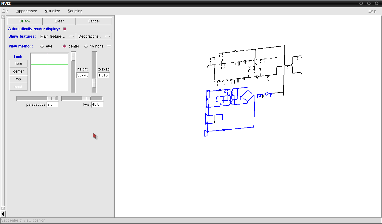
GRASS (http://grass.osgeo.org/) is a free software GIS (Geographical
Information System). It has a dwg importing module which depends on
the OpenDWG toolkit (proprietary). Due to the nature of the module,
they don't distribute it with the binary releases. I've written a new
module, roughly based on the previous, that uses LibreDWG. There's the
result. It is a DWG file
(http://www.naval.com/drawings/dwg/PRA430d.dwg) that we've been using
with testSVG, rendered with GRASS's nviz module. I think that it looks
aliased since GRASS is tuned for larger orders of magnitude
(kilometers) by default, and not circuits (centimeters). I need to
test it with a proper dwg file or change some configurations.

I'll submit it as soon as I get the INSERTs working.

Rodrigo Rodrigues da Silva
PoliGNU - Grupo de Estudos de Software Livre da Poli/USP
FSF Associate Member #7788
 grass_libredwg.png
Description: PNG image
- [libredwg] GRASS + LibreDWG,
Rodrigo Rodrigues da Silva <=